แอปพลิเคชันนำทางทะเล NavLink HD
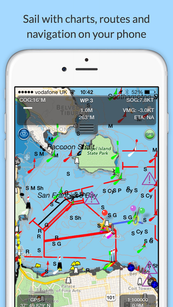
NavLink HD is a comprehensive marine navigation app that transforms your Apple device into a powerful chart plotter. This app offers a wide range of features including real-time GPS position plotting, live AIS ship overlay, NMEA instrument gauges, waypoints and route planning tools, weather buoy data, and A-B chart ruler for quick measurements. Users can mark favorite places, create and share routes effortlessly, and access high-resolution vector charts for various regions through separate in-app purchases.
For advanced functionality, users can opt for additional features via in-app purchase subscriptions such as yearly marine chart subscriptions and NavLink Pro, which provides live internet AIS feeds and an Augmented Reality HorizonView. NavLink HD supports the latest S57 digital mapping, automatic updates, and compatibility with Digital Yacht's wireless NMEA devices for seamless data streaming to your Apple device.